
Desert View Overnighter
Route Guide
Location
Grand Canyon - South Rim, Arizona, USA
Physical Difficulty*
4/10
Days to Ride
2 Days
Technical Difficulty*
6/10
Length
57 Miles
Tire Size
Recommended: 2.3"-2.8"
Seasons
Best: Late-Apr.- Early-June
Best: Sept. - October
Possible (But Hot): Late-June - August
Not Possible: November - Mid-April
Elevation Gain
4,203 Feet
Primary Surfaces
Rough Gravel; Smooth Gravel; Pavement
*Based on Bikepacking Roots’ Route Rating Scale
2. Route Description
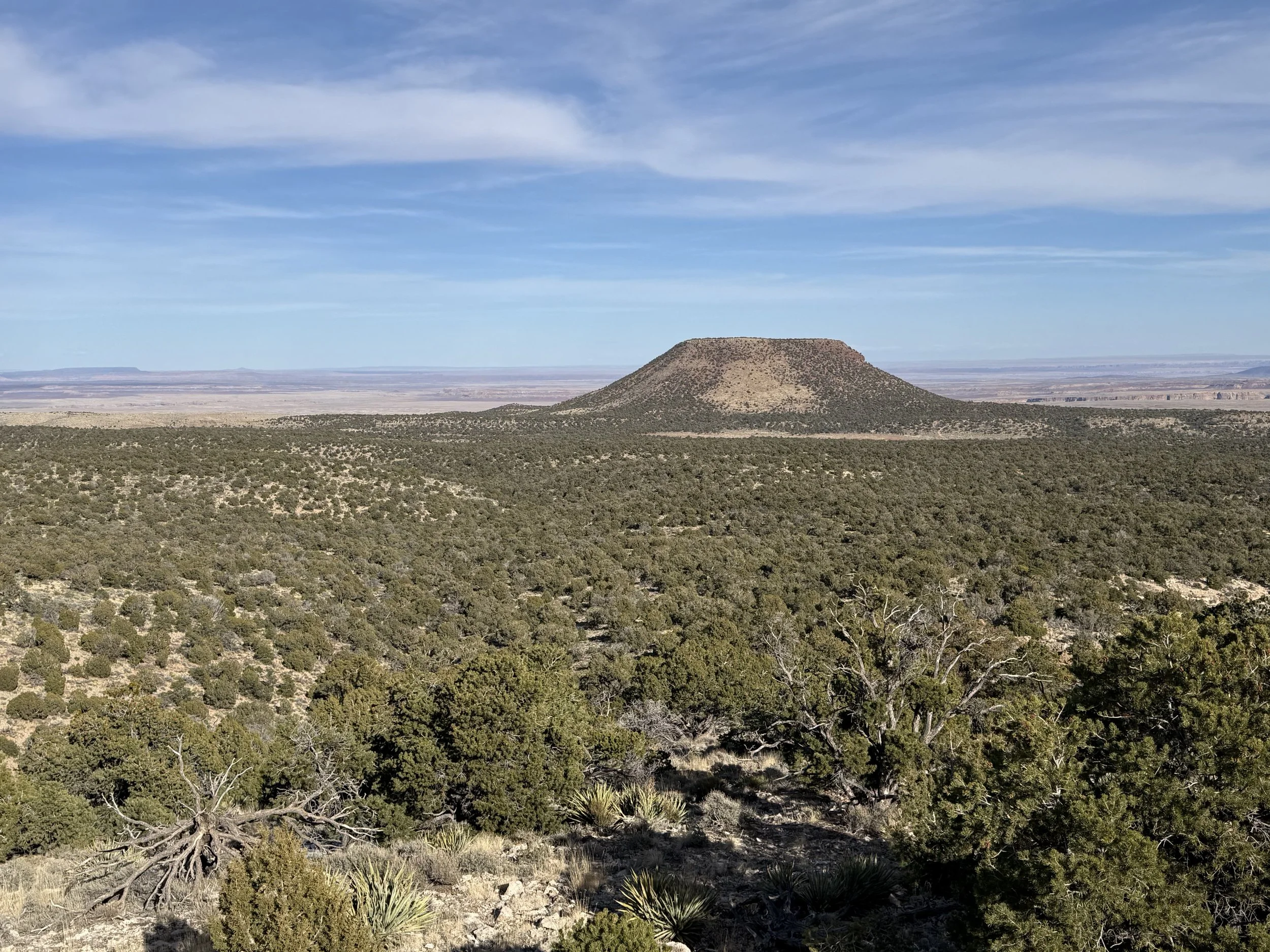
Desert View Overnighter takes riders to a chain of viewpoints along the eastern portion of Grand Canyon National Park's South Rim. The route travels down chunky doubletrack and along smooth pavement from overlooks of the Little Colorado River Gorge to Desert View Watchtower.
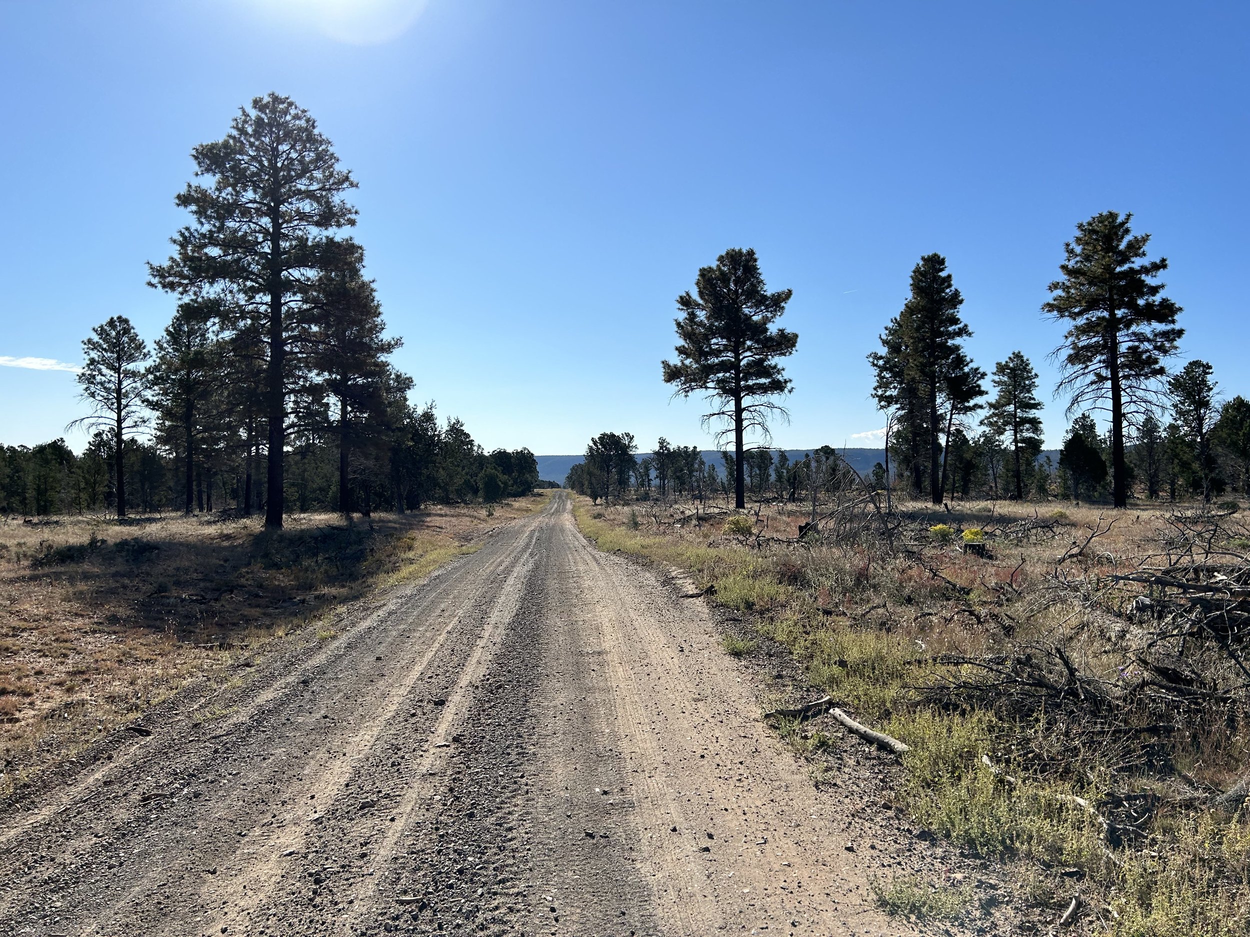
Bikepackers start at Grandview Lookout Tower up on the Coconino Rim in the midst of thick ponderosa pines. Riders start with some singletrack riding out to Vishnu Overlook and then continue on a short spur of Arizona Trail singletrack that joins dirt FR 307. Bikepackers then descend off the Coconino Rim past rentable Hull Cabin and through open sage plains of the Upper Basin. Cyclists then join abandoned paved Highway 64A where no cars are allowed and full of plants quickly taking back this stretch of tarmac. Pavement ends as riders turn onto primitive, chunky, and challenging doubletrack that climbs out to a stunning overlook of the Little Colorodo River Gorge. The dirt transitions to pavement as bikepackers join active Highway 64 and enter Grand Canyon National Park. A large climb proceeds up to Desert View where water, groceries, established camping, and the historic Desert View Watchtower wait. Riders next take the challenging and primitive descent/ascent out towards Cedar Mountain with its views at Cedar Viewpoint and Palisade Point. Upon return, riders stick exclusively to the pavemement as they ride along East Rim Drive past Navajo, Lipan, Tusayan, and Moran Points before heading into the forest once more to close the loop.
Highlights:
Viewpoints of the Grand Canyon including Vishnu Overlook, Little Colorado River Gorge, Desert View, Cedar Viewpoint, Palisade Point, Navajo Point, Lipan Point, Tusayan Overlook, and Moran Point.
Climbing Grandview Lookout Tower for a commanding view of the forest and Canyon lip.
Remote doubletrack out to sweeping views of the Navajo Nation.
Riding out on primitive track to Cedar Mountain with amazing views of the Canyon on a dirt road that comes up against the Canyon edge.
Taking a tour of historic Desert View Watchtower and attending the Cultural Demonstration Programs of local indigenous artists.
Visiting the Tusayan Pueblo Museum and its gardens.
3. Map and GPX
-
Purple = Improved Dirt Surface (Frequently Maintained, Usually Smoother)
Red = Rugged Dirt Surface (Infrequently Maintained, Typically Rougher/Rockier)
Brown = Primitive Dirt Surface (Rarely/Never Maintained, Particularly Rocky/Rutted/Eroded)
Black = Singletrack
Yellow = Hiking Trail (must park bike and hike/walk)
Blue = Vehicular Pavement
Green = Paved Bike Path


4. Route Difficulty, Surface Conditions, and Direction to Ride
Route Difficulty
Physical Difficulty = 4/10 (Regular rolling terrain with sustained climbing)
Technical Difficulty = 6/10 (Continuous sections of track may be rocky, loose, and steep; (e.g., 4×4 roads or singletrack in rugged/rocky terrain) suitable for riders with intermediate off-road experience)
The technical difficulty of the route is due to the abundance of primitive 4x4 roads out by the Little Colorado River Gorge Overlook and out to Cedar Mountain. Be prepared for slow and chunky riding. The portion of forest road that traces the bottom of the Coconino Rim is often washboarded as well.
The physical difficulty is mostly due to the climbing. Most of the route is found on the regularly rolling terrain of the Coconino Plateau that stretches between Flagstaff and the South Rim. Riders can expect to climb and descend regularly across hills and drainages.
Noteworthy Climbs
Climbing up to Desert View from the intersection with Highway 64.
Ascending back up the primtive, rocky road after heading out to Cedar Mountain.
The portion of East Rim Drive that heads back to Grandview after passing Moran Point.
Surface Conditions
Desert View Overnighter sticks to a mix of forest service dirt roads, chunky remote doubletrack, large swaths of pavement, and a small bit of singletrack. Dirt roads on top of the Coconino Rim and return to Highway 64 from the Little Colorado River Gorge Overlook are smooth and broad. The road that traces the bottom of the Coconino Rim is often full of washboards from ATV use. Luckily, the route goes down the washboard and lines that avoid the worse of it are frequent. The doubletrack that goes out to the Little Colorado River Gorge Overlook from abandoned Highway 64A can be rocky, primitive, and require some hike-a-bike. If it's late in the season, it can be especially eroded and feature vegetation thickly encroaching. Lastly, the rocky road out to Cedar Mountain can be especially challenging for both its steep grade and poor maintenance.
The paved portions of the route start with a robust shoulder that disappears once inside Grand Canyon National Park boundaries. Be defensive, wear bright colors, and use flashing lights. Motorists will definitely be looking at the Canyon, but they tend to drive slowly along East Rim Drive.
If any rain/snow is forecast, most of the unpaved route will become peanut butter/death mud and impassable in places. Leave No Trace and avoid riding at these times until the route dries out. In addition, flash flooding from precipitation is a possibility in washes or low areas - stay safe and stay out of those locations during monsoon rain dumps.
Noteworthy Primitive, Rocky Surfaces
The primitive doubletrack that carries bikepackers out to the Little Colorado River Gorge Overlook from abandoned Highway 64A.
The road leading out to Cedar Mountain and Palisade Point.
Noteworthy Vehicular Pavement
All of Highway 64/East Rim Drive: This is a long stretch of highway pavement with little shoulder, hills, and curves. It stretches from just outside Grand Canyon National Park at the bottom of the climb to Desert View all the way to the South Kaibab Trailhead. The portion outside the National Park has a fantastic and broad shoulder for cyclists to ride in. This shoulder almost entirely disappears once cyclists enter the Park. Wear bright colors, ride defensively, and have a flashing light. This stretch of pavement is frequented by cyclists and is a part of the official Grand Canyon Connector by the Adventure Cycling Association. Luckily, most of the viewpoints/parking areas require side-spur-roads meaning people will likely be keeping their eyes on the road while driving. There are lots of pull-outs and parking areas for you to get off the road for breaks, views, and capes too.
Direction to Ride
The route is intended to be ridden in a counterclockwise direction.
5. Parking
The route is intended to be ridden in a counterclockwise direction. Park overnight at one of the many pullouts near Grandview Lookout Tower in the Kaibab National Forest/Baaj Nwaavjo I'tah Kukveni National Monument.
6. Water and Food
Water Reliability
Water is scarce along this route. The Kaibab National Forest is considered the driest national forest in the United States. Although the South Rim receives an average of 15.56 inches of moisture a year, most quickly percolates through the porous rock of Kaibab Limestone that makes up the upper layers of this area. Within the canyon, water exits through numerous springs, but up on top, it's a dry area. Plan to carry several liters of water, sometimes enough to last at least 24 hours and more than you think you'll need should you arrive at a source and find it dry.
Definite water can be found in at Desert View in Grand Canyon National Park. Beyond that, water is mostly found in dirt cattle tanks, metal cattle tanks, and Arizona Game and Fish Water Catchments (Wildlife Tanks). Wildlife tanks can be chock full of bugs and algae in the summer, but are safe to drink with treatment/purification. AZGFD Wildlife Tanks help provide water to wildlife in the ever-drying environment of the southwest under climate change. There is no camping within 0.25 miles of AZGFD Wildlife Tanks (or other water sources). This route requires riders to dry camp.
Food Resupplies
Food resupplies are located at Desert View in Grand Canyon National Park.
7. Fees and Permits
Kaibab National Forest and Baaj Nwaavjo I’tah Kukveni National Monument has no fees.
Grand Canyon National Park requires a fee for entry. No cash, credit/debit only. ($35 for a vehicle; $20 for a bicycle).
8. Important Information
Hunting Season:
Starts in September and goes through December. Hunters will mostly be seeking deer and elk. Expect to see more trucks, backcountry campers, ATVs, and individuals on foot. WEAR ORANGE and make yourself visible as you ride. Be smart and be seen during hunting season. Wildlife Tanks may have more hunters scoping them out.
Dark Skies:
Grand Canyon National Park is an International Dark Sky Park. This means that you can expect to have anywhere between Bortle Class 1 - 3 night skies overhead (even better night viewing during a new moon). The Bortle Class Scale is used to rate night skies on their clarity and lack of light pollution. A Bortle Class 1 is the darkest possible and there are several locations along these routes where, should you camp, you will have this level of darkness. Here, night skies will be virtually unimpeded by artificial light. You can use the following sites to explore more:
Black Bears:
There are black bears which means you need to properly store your food at night using a bear-aware method.
Fences:
There may be "cowboy fences" on this route which consist of barbed wire wrapped around vertical wooden branches that are strung across roads. They can be opened by removing a loop of wire on one side. Most importantly, leave fences as you found them; re-close them if they were closed.
Hantavirus and Plague:
Bubonic plague and hantavirus are frequent enough amongst the rodent population that you should avoid their saliva, feces, urine, and direct bodily contact. Be careful when entering old cabins and caves where droppings are plentiful and ventilation is limited. These are prime areas for possible contraction of these diseases.
9. General Access and Tribal Nations
Bikes are STRICTLY forbidden below the rim in the inner gorge of the Grand Canyon. DO NOT RIDE YOUR BIKE DOWN INTO THE CANYON - you will get fined, it is illegal, and you will hurt the perception and opportunities of other bikepackers on this route. There are certain trails on top that are also off-limits to bikes; this route expressly avoids them. No cross-country travel in Grand Canyon National Park; practicing Leave No Trace means staying on established trails, roads, and paths.
Finally, respect tribal land and do not ride without permission in the Navajo Nation. This route stays explicitly within land domains where riding is public and legal. Although it may approach boundaries with the surrounding tribal nations, you should never ride onto the reservations without securing tribal government permission. Doing so otherwise is disrespectful and unlawful. I must note that although this route stays on "public lands," the formation of Grand Canyon National Park involved the forced removal of the Havasupai, and they have endured legal battles to keep their vastly smaller chunk of land out of their historical precedent. Know the land you are riding on is traditionally theirs, know their current reservation boundaries are smaller than where they historically inhabited, and know where you are riding to keep yourself both legal and respectful.
10. Camping
There is no dispersed camping within the boundaries of Grand Canyon National Park. Desert View Campground is the only established campground within the National Park along the route. All sites here are by reservation only, and there are no hiker/biker sites.
If you want to backcountry camp anywhere above the Rim in Grand Canyon National Park, you'll need to navigate to the Recreation.gov page for the park and make sure to choose the proper Use Area. This Use Area Map will help you determine which zone is appropriate for your intended backcountry campsite.
Outside of GCNP in the the Baaj Nwaavjo I'tah Kukveni National Monument/Kaibab National Forest, excellent and numerous dispersed camping abounds. Make sure to pay attention to boundary lines between the National Monument and Grand Canyon National Park.
11. Sample Route Itinerary
This is a suggested itinerary. Use it as a rough guide for your own planning purposes. Feel free to use it, adapt it, or don't use it all and make your own plans. Plan your trip on this route based on your own strengths, comfortabilities, experiences, wants, and needs.
-
Mileage: 34 Miles
Elevation Gain: 2100 Feet
Water: Wildlife Tanks; Desert View
Resupply: Desert View Market and Deli
Camping: Reserve a campsite at Desert View Campground (no hiker/biker sites) or dispersed camp off a dirt road right below the entrance to the Park (this means a few more miles and feet of gain tomorrow).
-
Mileage: 23 Miles
Elevation Gain: 2200 Feet
Water: Desert View
Resupply: None
Camping: Finish! Lots of dispersed camping is available at Grandview Lookout Tower