Red Butte Overnighter
Route Guide
Location
Grand Canyon - South Rim, Arizona, USA
Physical Difficulty*
4/10
Days to Ride
2 Days
Technical Difficulty*
4/10
Length
74 Miles
Tire Size
Recommended: 2.2"-2.5"
Seasons
Best: Late-Apr.- Early-June
Best: Sept. - October
Possible (But Hot): Late-June - August
Not Possible: November - Mid-April
Elevation Gain
4,361 Feet
Primary Surfaces
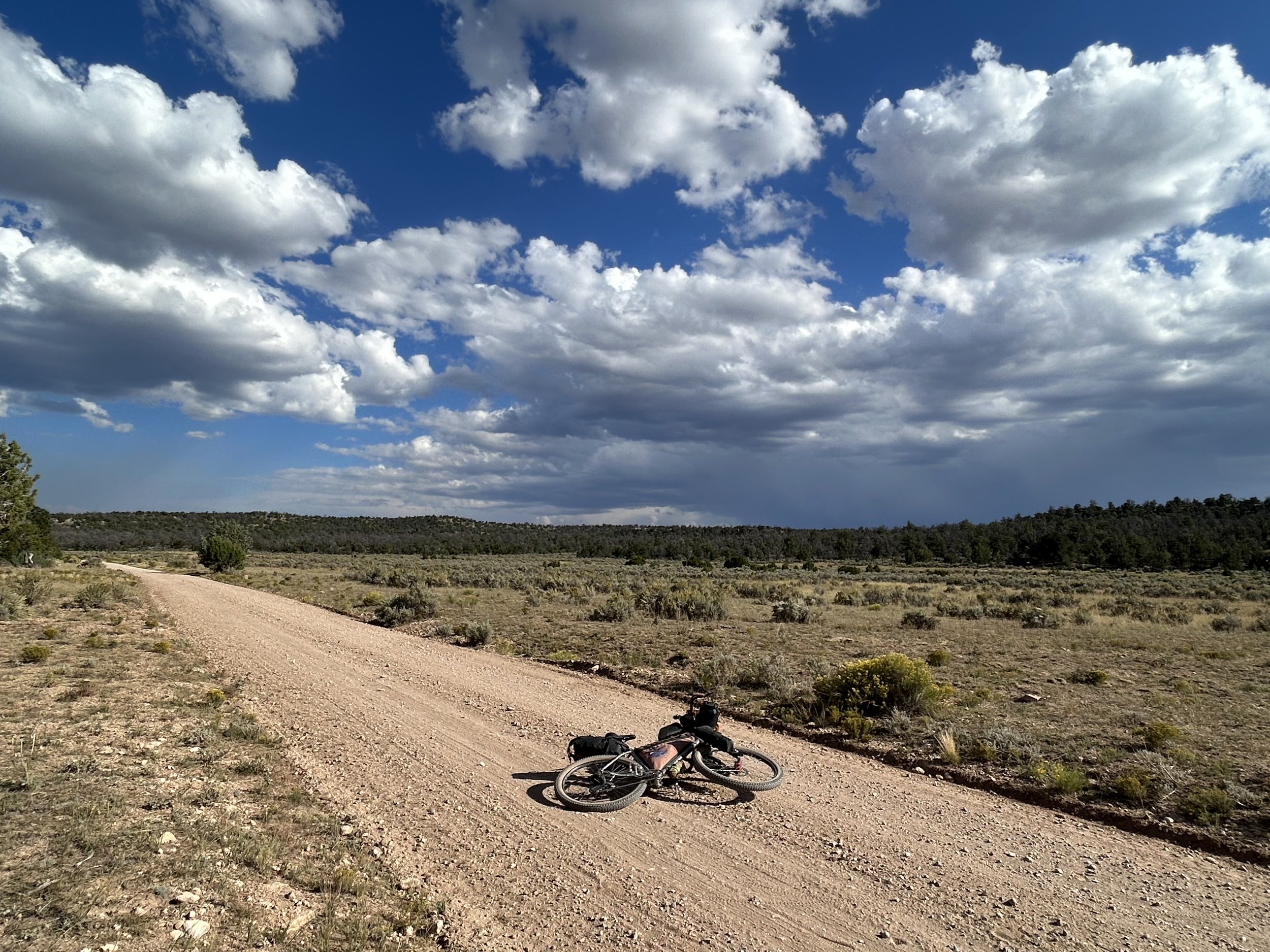
Rough Gravel; Smooth Gravel
*Based on Bikepacking Roots’ Route Rating Scale
2. Route Description
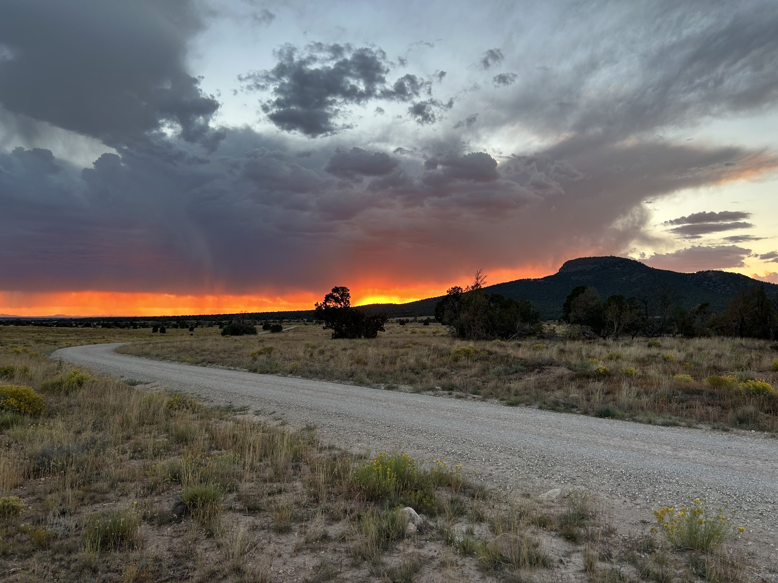
Red Butte Overnighter takes bikepackers on a loop ride out to culturally significant Red Butte in the heart of the Baaj Nwaavjo I'tah Kukveni National Monument. This rise of rock is iconic amid the pinyon-juniper grasslands against the skyline of the South Rim; it is also considered the birthplace of the Havasupai people.
Cyclists start in Tusayan riding through montane woodlands of ponderosa pines before descending to savannah grasslands near Anita Station. A night here affords incredible Dark Skies as bikepackers camp amid the vibrant Milky Way. Bikepackers then approach the base of Red Butte where a side-hike to its summit brings incredible views of the Baaj Nwaavjo I'tah Kukveni National Monument from a historic fire lookout tower. The night can be spent camped below the silhouette of this culturally significant landform amid thickets of pinyon and juniper. The next morning, riders ascend into larger ponderosa forests along Skinner Ridge. From here, it's a quick descent back to Tusayan to finish the loop.
Highlights:
Bortle 1 Dark Skies from Anita Station
Hiking up culturally important Red Butte and checking out its historic fire lookout tower.
Riding through the heart of the Baaj Nwaavjo I'tah Kukveni National Monument
Cycling through vast pinyon-juniper grasslands and park-like ponderosa forests.
Great, broad dirt roads that stretch across the South Rim of Grand Canyon National Park.
3. Map and GPX
-
Purple = Improved Dirt Surface (Frequently Maintained, Usually Smoother)
Red = Rugged Dirt Surface (Infrequently Maintained, Typically Rougher/Rockier)
Brown = Primitive Dirt Surface (Rarely/Never Maintained, Particularly Rocky/Rutted/Eroded)
Yellow = Hiking Trail (must park bike and hike/walk)
Green = Paved Bike Path


4. Route Difficulty, Surface Conditions, and Direction to Ride
Route Difficulty
Physical Difficulty = 4/10 (Regular rolling terrain with sustained climbing)
Technical Difficulty = 4/10 (Track has occasional obstacles and steep sections (e.g., maintained forest roads, mellow singletrack); suitable for beginner riders with some off-road experience.)
The technical difficulty of the route is due to the climbing and mix of extensive forest service roads.
The physical difficulty is due to the undulating climbs and descents the route makes as it travels across the Coconino Plateau on the South Rim of Grand Canyon National Park.
Noteworthy Climbs
Hiking up Red Butte is a 3 mile trail roundtrip that involves about 850 feet of gain.
There is long, but gradual climb from the base of Red Butte to the top of Skinner Ridge.
Surface Conditions
Red Butte Overnighter sticks to a mix of forest service dirt roads and chunky doubletrack. These dirt roads in the Baaj Nwaavjo I'tah Kukveni National Monument are often well-maintained but can feature embedded rocks and some classic Colorado Plateau ruts at times. After monsoon season as well as extensive vehicular use, some of these roads can become rockier and more eroded.
If any rain/snow is forecast, most of the unpaved route will become peanut butter/death mud and impassable in places. Leave No Trace and avoid riding at these times until the route dries out. In addition, flash flooding from precipitation is a possibility in washes or low areas - stay safe and stay out of those locations during monsoon rain dumps.
Noteworthy Primitive, Rocky Surfaces
A small section of rocky and primitive doubletrack that takes riders to Little Red Horse Wash.
Direction to Ride
The route is intended to be ridden in a counterclockwise direction.
5. Parking
Park your car for the duration of the route at the Grand Canyon Visitor Center - IMAX in Tusayan, AZ. Park in the back of the building in the paved parking area, but not on the adjacent gravel lot. Make sure to check into the Visitor Center with your (a) car make, (b) car model, (c) license plate number, and (d) expected return date; just let them know you're riding the COTC. If the center isn’t open, leave a note on your dashboard saying, “Bikepacking the Capes of the Canyon Route - Expected return date XX/XX/XXXX." The Center is open seven days a week from 9 am - 6 pm.
6. Water and Food
Water Reliability
Water is scarce along this route. The Kaibab National Forest is considered the driest national forest in the United States. Although the South Rim receives an average of 15.56 inches of moisture a year, most quickly percolates through the porous rock of Kaibab Limestone that makes up the upper layers of this area. Within the canyon, water exits through numerous springs, but up on top, it's a dry area. Plan to carry several liters of water, sometimes enough to last at least 24 hours and more than you think you'll need should you arrive at a source and find it dry.
Definite water can only be found in Tusayan. Beyond that, water is mostly found in dirt cattle tanks, metal cattle tanks, and Arizona Game and Fish Water Catchments (Wildlife Tanks). Wildlife tanks can be chock full of bugs and algae in the summer, but are safe to drink with treatment/purification. AZGFD Wildlife Tanks help provide water to wildlife in the ever-drying environment of the southwest under climate change. There is no camping within 0.25 miles of AZGFD Wildlife Tanks (or other water sources). This route requires riders to dry camp.
Food Resupplies
Food resupplies are only found at the start and end in Tusayan.
7. Fees and Permits
Kaibab National Forest and Baaj Nwaavjo I’tah Kukveni National Monument has no fees.
8. Important Information
Hunting Season:
Starts in September and goes through December. Hunters will mostly be seeking deer and elk. Expect to see more trucks, backcountry campers, ATVs, and individuals on foot. WEAR ORANGE and make yourself visible as you ride. Be smart and be seen during hunting season. Wildlife Tanks may have more hunters scoping them out.
Dark Skies:
Grand Canyon National Park is an International Dark Sky Park. This means that you can expect to have anywhere between Bortle Class 1 - 3 night skies overhead (even better night viewing during a new moon). The Bortle Class Scale is used to rate night skies on their clarity and lack of light pollution. A Bortle Class 1 is the darkest possible and there are several locations along these routes where, should you camp, you will have this level of darkness. Here, night skies will be virtually unimpeded by artificial light. You can use the following sites to explore more:
Black Bears:
There are black bears which means you need to properly store your food at night using a bear-aware method.
ATVs:
ATVs are somewhat common around Red Butte. Outside of here, ATVs are much more rare across the Coconino Plateau, although you will see them. However, I have found drivers are pretty respectful, will check on you/offer you water, and give you space when passing.
Fences:
There may be "cowboy fences" on this route which consist of barbed wire wrapped around vertical wooden branches that are strung across roads. They can be opened by removing a loop of wire on one side. Most importantly, leave fences as you found them; re-close them if they were closed.
Hantavirus and Plague:
Bubonic plague and hantavirus are frequent enough amongst the rodent population that you should avoid their saliva, feces, urine, and direct bodily contact. Be careful when entering old cabins and caves where droppings are plentiful and ventilation is limited. These are prime areas for possible contraction of these diseases.
9. General Access and Tribal Nations
This route stays explicitly within land domains where riding is public and legal. Although it may approach boundaries with the surrounding tribal nations, you should never ride onto the reservations without securing tribal government permission. Doing so otherwise is disrespectful and unlawful. I must note that although this route stays on "public lands," the formation of Grand Canyon National Park involved the forced removal of the Havasupai, and they have endured legal battles to keep their vastly smaller chunk of land out of their historical precedent. Know the land you are riding on is traditionally theirs, know their current reservation boundaries are smaller than where they historically inhabited, and know where you are riding to keep yourself both legal and respectful.
10. Camping
Dispersed camping is abundant and excellent in the the Baaj Nwaavjo I'tah Kukveni National Monument/Kaibab National Forest.
11. Sample Route Itinerary
This is a suggested itinerary. Use it as a rough guide for your own planning purposes. Feel free to use it, adapt it, or don't use it all and make your own plans. Plan your trip on this route based on your own strengths, comfortabilities, experiences, wants, and needs.
-
Mileage: 46 Miles
Elevation Gain: 3000 Feet
Water: Wildlife Tank
Resupply: None
Camping: Dispersed camping out near Red Butte
-
Mileage: 28 Miles
Elevation Gain: 1400 Feet
Water: Wildlife Tank, Tusayan
Resupply: Tusayan
Camping: Finish! Grab lodging in Tusayan or dispersed camp nearby in the national monument.