
Kaibab Spine Overnighter
Route Guide
Location
Grand Canyon - North Rim, Arizona, USA
Physical Difficulty*
5/10
Days to Ride
2 - 3 Days
Technical Difficulty*
4/10
Length
76 Miles
Tire Size
Recommended: 50 mm -2.6"
Seasons
Best: Mid-May - Mid-Oct.
Not Possible: Late October - Late-May
Elevation Gain
5,462 Feet
Primary Surfaces
Smooth Gravel; Rough Gravel
*Based on Bikepacking Roots’ Route Rating Scale
2. Route Description
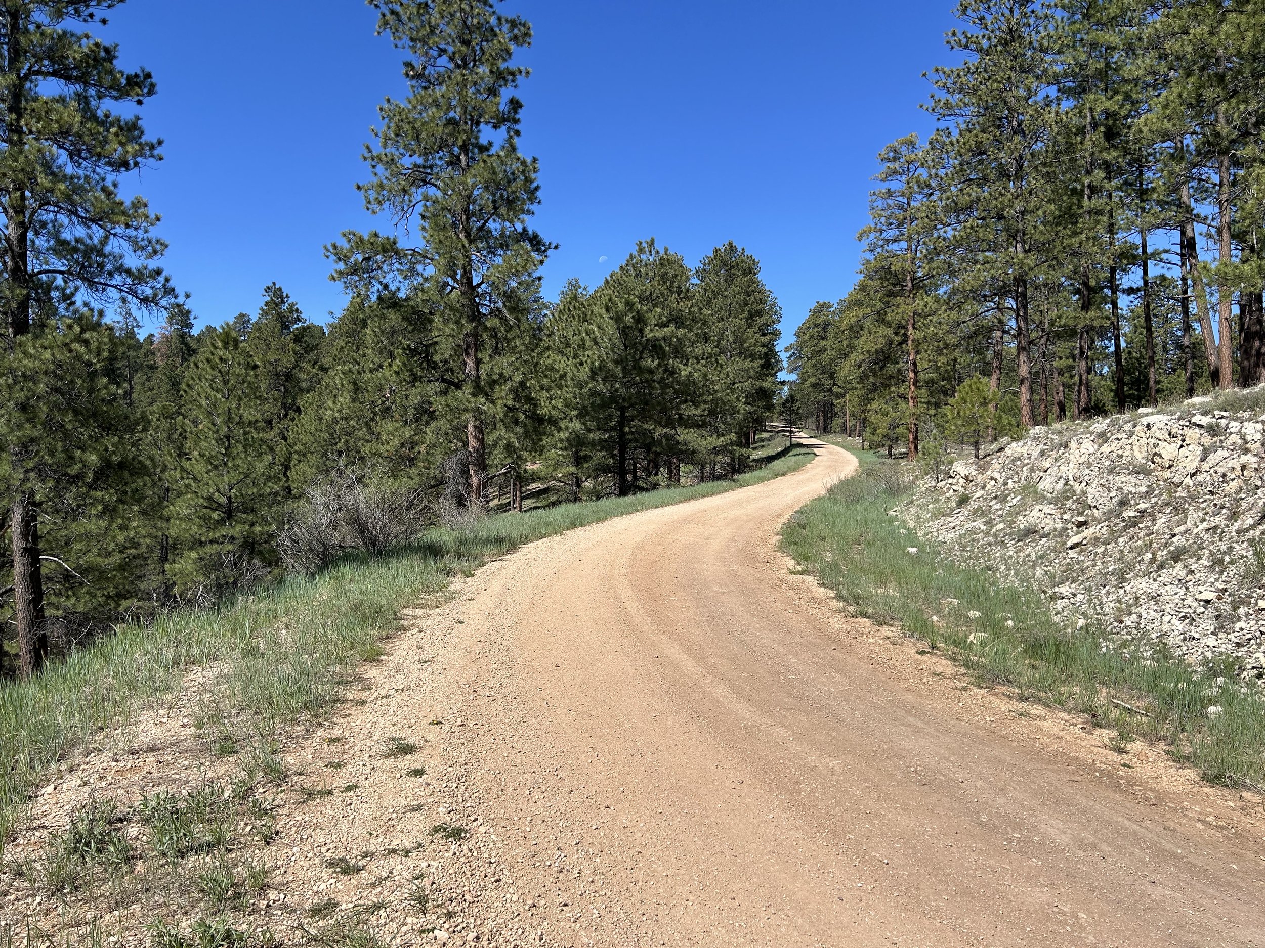
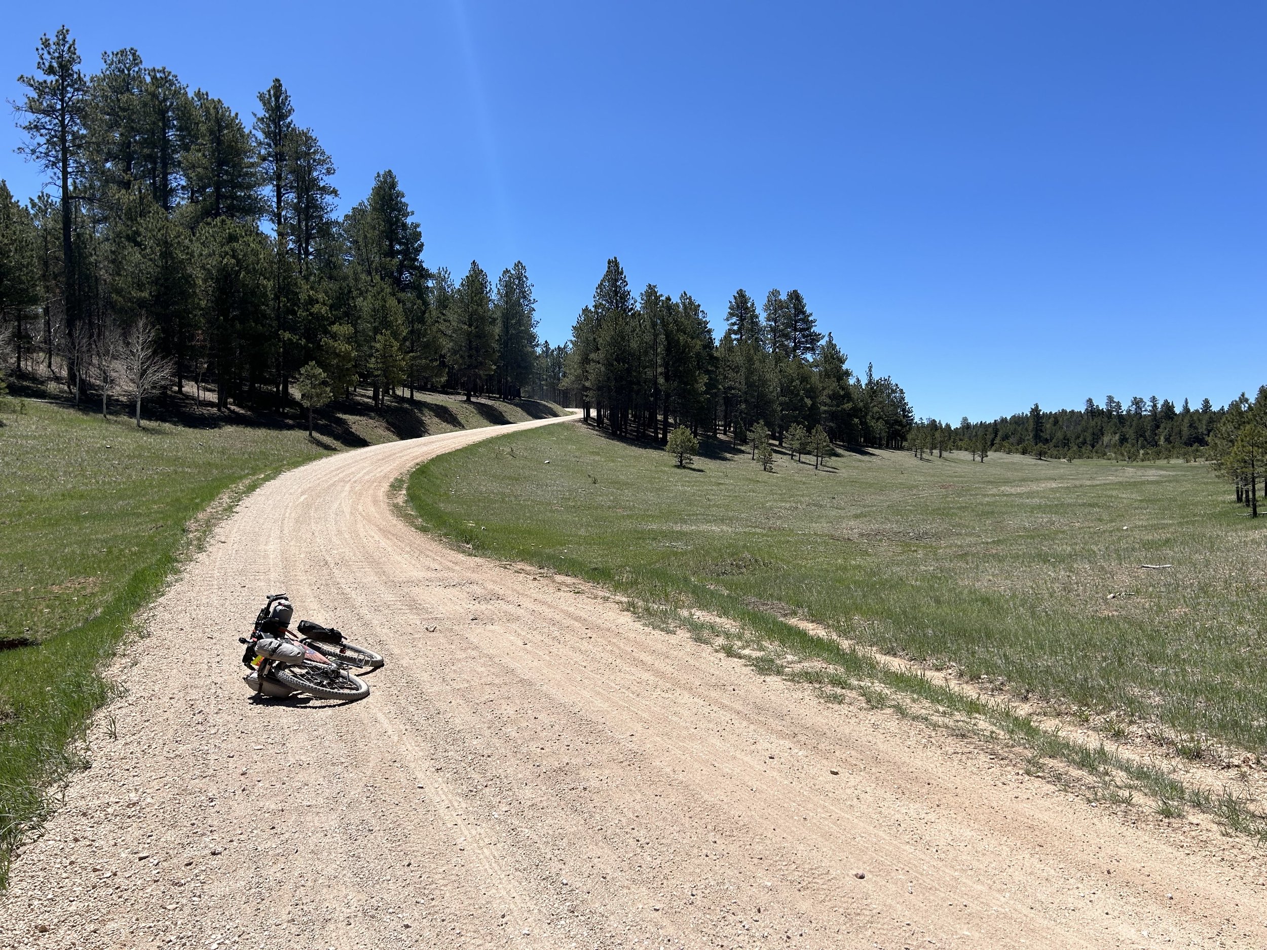
Kaibab Spine Overnighter is a high-elevation ride across the sprawling montane and subalpine forests and meadows of the Kaibab Plateau on the North Rim of the Grand Canyon.
Starting at Jacob Lake, bikepackers do a slow climb through thick aspen groves, old burn scars, robust pine forests, and verdant meadows. Riders should keep their eyes open for deer, goshawks, and Kaibab squirrels. Bikepackers ride along a 9000 foot ridge via superb gravel roads to the Kaibab Plateau High Point at 9200 feet. From there, it's a quick descent to Demotte for a resupply and the option of overnight camping at its campground or a room at the Kaibab Lodge. This area is a situated in a large subalpine meadow where bison and deer frequent. Next, it's back up to the high point for a long and gradual descent through spruce and firs down to ponderosas amid exposed cliff faces. Riders arrive at Big Springs Cabin Site where they can grab water from the gushing waterfall coming out of the mountain; bikepackers can reserve a historic USFS cabin ahead of time and stay for the night. Finally, it's a challenging ascent up beautiful Warm Springs Canyon back to 8000 feet where riders finish the loop back at Jacob Lake.
Highlights:
High-elevation cooler summer riding through aspen and spruce in northern Arizona.
Great water sources and lodging at Jacob Lake, Demotte, and Big Springs.
Abundant tent camping at dispersed sites or establlished campgrounds in the Kaibab National Forest.
Abundant wildlife viewing opportunities
Cycling through thick subalpine forest and broad grassy subalpine meadows.
Fantastic, well-maintained gravel roads.
Biking through the exposed geology of Warm Springs Canyon.
Incredible fall colors from changing aspen for those riding in autumn.
Viewing historic Jacob Lake Lookout Tower, Dry Park Lookout Tower, and Jacob Lake Ranger Station.
3. Map and GPX
-
Purple = Improved Dirt Surface (Frequently Maintained, Usually Smoother)
Red = Rugged Dirt Surface (Infrequently Maintained, Typically Rougher/Rockier)
Blue = Vehicular Pavement


4. Route Difficulty, Surface Conditions, and Direction to Ride
Route Difficulty
Physical Difficulty = 5/10 (Rugged terrain with frequent climbs, some of which may be steep and unrelenting)
Technical Difficulty = 4/10 (Track has occasional obstacles and steep sections (e.g., maintained forest roads, mellow singletrack); suitable for beginner riders with some off-road experience)
The technical difficulty of the route is due to the presence of almost entirely maintained US Forest Service roads.
The physical difficulty is mostly due to the climbing. There is a lot of sustained gradual riding along the spine of the Kaibab Plateau. However, there are two notably steep sections when climbing up from Demotte and when climbing up Warm Springs Canyon.
Noteworthy Climbs
Climbing back to the Kaibab Plateau High Point after descending to Demotte.
The ascent up Warm Springs Canyon is steep and unrelenting. But it's also beautiful.
Surface Conditions
Kaibab Spine Overnighter travels down US Forest Service roads that are regularly maintained, wide, lightly graveled, and sometimes hero dirt. All roads in this area are often littered with tree blowdowns come early summer. The deadfall will get removed, but anyone traveling in the early season may have to go around/over trees until agencies clear them. Almost all the riding is not technical.
Direction to Ride
The route is intended to be ridden in a clockwise direction.
5. Parking
Jacob Lake Inn is the official start and place to leave your vehicle for the duration of the route. Follow these steps below:
Jacob Lake Inn has graciously agreed to allow bikepackers to park vehicles on their property. There is no fee to park, and you are able to leave your vehicle at Jacob Lake Inn for however long you need; you’ll just need to provide the date you plan to finish and pick your vehicle back up. Reach out before your trip to confirm parking will be available (928-643-7232, jacob@jacoblake.com). When you arrive, head to the front desk to fill out a slip with your vehicle information and signature. Have your intended finish-date ready. After signing, the front desk clerk will let you know where to park your vehicle. If you are part of a group bringing more than 10 vehicles, you will need to let them know at least 4 days in advance so they can confirm with their managers. Give them big thanks for this opportunity!
6. Water and Food
Water Reliability
Water can be reliably located at Jacob Lake, Demotte, and Big Springs. These water sources use spigots and don't need treatment. However, these sources are spaced apart and will require riders to carry several liters of water with them from the beginning of the day to get to their destinations.
Beyond these reliable sources, water may be found in dirt cattle tanks, unlisted springs, and unreliable seasonal creeks.
Food Resupplies
Food resupplies are located in Jacob Lake and in Demotte.
7. Fees and Permits
Kaibab National Forest has no fees.
Big Springs Cabin Site requires advanced reservations for overnight stays.
8. Important Information
Hunting Season:
Starts in September and goes through December. Hunters will mostly be seeking deer and elk. Expect to see more trucks, backcountry campers, ATVs, and individuals on foot. WEAR ORANGE and make yourself visible as you ride. Be smart and be seen during hunting season. Wildlife Tanks may have more hunters scoping them out.
Dark Skies:
Grand Canyon National Park is an International Dark Sky Park. This means that you can expect to have anywhere between Bortle Class 1 - 3 night skies overhead (even better night viewing during a new moon). The Bortle Class Scale is used to rate night skies on their clarity and lack of light pollution. A Bortle Class 1 is the darkest possible and there are several locations along these routes where, should you camp, you will have this level of darkness. Here, night skies will be virtually unimpeded by artificial light. You can use the following sites to explore more:
Black Bears:
There are black bears which means you need to properly store your food at night using a bear-aware method.
Bugs:
Mosquitoes and biting flies can be abundant on this route in the forest valleys and drainages where moisture and standing water collect. This will be especially true in the summer and early fall, especially if precipitation has been plentiful.
Fences:
There may be "cowboy fences" on this route which consist of barbed wire wrapped around vertical wooden branches that are strung across roads. They can be opened by removing a loop of wire on one side. Most importantly, leave fences as you found them; re-close them if they were closed.
Hantavirus and Plague:
Bubonic plague and hantavirus are frequent enough amongst the rodent population that you should avoid their saliva, feces, urine, and direct bodily contact. Be careful when entering old cabins and caves where droppings are plentiful and ventilation is limited. These are prime areas for possible contraction of these diseases.
9. General Access and Tribal Nations
You are allowed to cycle on any established dirt roads.
I must note that although this route stays on "public lands," the formation of Grand Canyon National Park and surrounding land designations involved the forced removal of tribes such as the Havasupai, and they have endured legal battles to keep their vastly smaller chunk of land out of their historical precedent. Know the land you are riding on is traditionally theirs, know their current reservation boundaries are smaller than where they historically inhabited, and know where you are riding to keep yourself both legal and respectful.
10. Camping
In the Kaibab National Forest, excellent and numerous dispersed camping abounds. Riders can also get either First-Come, First-Served or reserved campsites at Jacob Lake Campground, Kaibab Camper Village, or Demotte Campground. There are also options to reserve lodging in cabins and hotels at Jacob Lake Inn, Kaibab Lodge, or Big Springs Cabin Site.
11. Sample Route Itinerary
This is a suggested itinerary. Use it as a rough guide for your own planning purposes. Feel free to use it, adapt it, or don't use it all and make your own plans. Plan your trip on this route based on your own strengths, comfortabilities, experiences, wants, and needs.
-
Mileage: 37 Miles
Elevation Gain: 2800 Feet
Water: Jacob Lake; Demotte
Resupply: Demotte at the North Rim Country Store or the Kaibab Lodge
Camping: Demotte Campground or dispersed camping in the woods nearby
-
Mileage: 25 Miles
Elevation Gain: 800 Feet
Water: Demotte; Castle Spring; Big Springs
Resupply: None
Camping: Reserve a cabin at Big Springs Cabin Site ahead of time or dispersed camping south of Big Springs at a pullout near Castle Spring
-
Mileage: 16 Miles
Elevation Gain: 2000 Feet
Water: Big Springs; Jacob Lake
Resupply: Jacob Lake Inn has a restaurant, bakery, and convenience store
Camping: Jacob Lake Inn, Jacob Lake Campground, Kaibab Camper Village, or dispersed camping in the woods nearby